Paul Da Serra Plateau
Largest plateau in Madeira, 1,500m above sea level
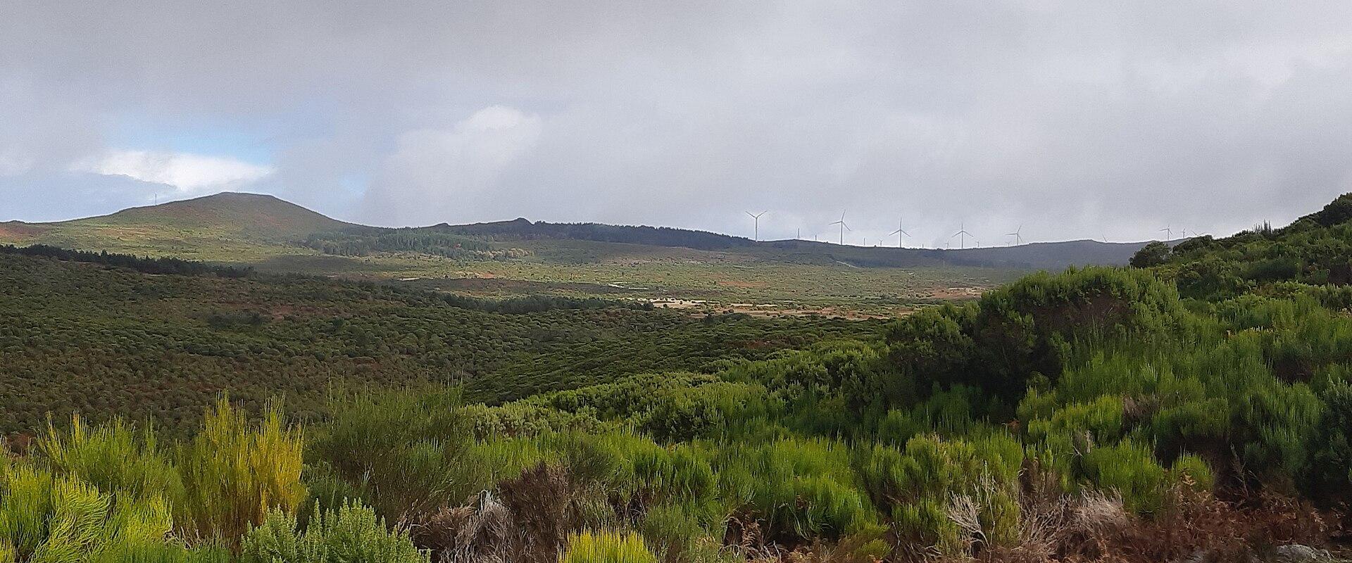
Paul da Serra is the largest plateau on Madeira, a wide, high moorland that occupies the western half of the island's mountainous core at an altitude of between about thirteen and fifteen hundred metres. After the steep, terraced slopes and deep valleys of the coast, it comes as a surprise: a rolling, open landscape of grass, heather, bracken, and scattered rocks, with few trees and a very large sky. The name Paul means marsh, and the plateau is indeed boggy in places, because its role is to collect rain and mist and release the water slowly.
That function is of great importance for the island. The plateau acts as a sponge, soaking up the moisture of the clouds that drift in from the Atlantic, and the water seeps into the ground and emerges as springs that feed streams and the levadas, the irrigation channels that distribute water across Madeira. Without this natural reservoir, farming on the dry south coast would be much harder. Sheep and cattle graze on the open pasture, and the plateau is also used for wind energy, with turbines dotting the skyline.
The vegetation is of interest to botanists. Low heath plants and grasses cover the ground, and endemic species such as Madeira thyme grow among the rocks, along with a variety of mosses and lichens. Birds such as the Madeira firecrest and buzzards can be seen, and in clear weather the sky is full of larks and swifts. In spring, wild flowers appear in patches, adding colour to the moor.
The views are another attraction. On a clear day you can look north to the coast and the Atlantic, south to the sea, and east toward the central peaks, though cloud and mist are frequent and can obscure everything within minutes. Temperatures are cooler than on the coast, and the wind is strong and cold, so bring warm clothing and a waterproof jacket even in summer. The roads across the plateau are exposed to fog, and drivers should take care.
Trails start from the plateau, including routes to the Rabaçal valley with its levada walks and waterfalls, and the nearby ancient forest at Fanal is within reach. The plateau lies about thirty kilometres from Funchal, in the municipality of Ponta do Sol, and is easily reached by car. It suits hikers, drivers, and photographers who like wide landscapes.
Categories
More photos coming soon
Nearby Attractions
Other places to visit in Ponta do Sol
Frequently Asked Questions
Quick Facts
Best Time to Visit
Early July to mid-September offers the sunniest, warmest weather for beach and outdoor activities, but Ponta do Sol is pleasant year-round.